
Last week Aena announced a new satellite navigation system is available for landings at the Spanish airports through a press release which translation follows:
The GBAS system is already available at one Spanish airport
Aena is worldwide leader in starting new technologies and introduces operations based on satellite navigation
05 May 2014
As from today, Aena offer the possibility of landing at a Spanish airport using a modern satellite navigation system which suppose a significant step with regard to safety, cost savings and effectiveness for the air transport users.
This is the satellite navigation system named GBAS (Ground Based Augmentation System) which improves the GPS signal in the airport surroundings with a 40 Kilometre range and enables the pilot to perform precision approaches through both runway heads without requiring the other conventional systems.
This new system meets the European regulations and has the AESA’s approval. From now on, any airline which has equipped aircrafts and trained crews will be able to fly on GBAS, taking benefit from its high performance.
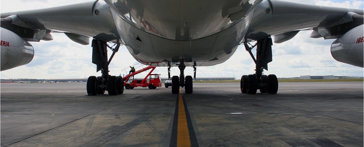
The first plane which will use this technology is an Air Berlin aircraft expected to land today at 16:30 in Málaga-Costa del Sol airport (the first airport where the system is operative). Air Berlin has cooperated with Aena in the project since 2012 and has several equipped and certified aircrafts for GBAS flights as well as a trained crew, with skills to perform this kind of operations.
The introduction of the GBAS precision approach procedures is an important technologic landmark for the satellite navigation not only in Spain but in the world, only possible thanks to the efforts made by a committed team led from Aena and with the Ministry of Development’s agreement in regard to new technology installations. After 50 years, it is the first time that a new technology on precision landing and approach systems starts operating in Spain.
This project is the result of a 15 year’s work, during which we passed from an experiment to achieving the current system (manufactured by Honeywell) in which it was necessary to make tests both at the ground and in-flight and to meet all the regulatory requirements.
Aena has been developing an internationally recognised key role in the operational introduction of the GBAS systems through its participation in projects for the future developments of navigation systems. The Málaga GBAS system is the second in Europe (the fourth in the world) which becomes operative
The start of the GBAS system involves the incorporation of new satellite navigation technology based services in the Aena’s portfolio. This way a cycle is complete in which Aena has gone becoming more important in the satellite navigation system introduction process. This process started in 1999 when the investigation and development tasks were performed in cooperation with the European Space Agency. Then, Aena started to operate the European satellite navigation system and, afterwards, the process continued with its participation in providing this service in Europe. Finally, Aena provides these services for the benefit of airlines and other air transport users. Hence, the work performed in the last years for the satellite navigation to become a reality in our country is already consolidated.
Benefits of the system
GBAS complements the Satellite Navigation Global Systems, improving its performance within a local service area. It is designed to give precision final approach service making possible to perform different approaches, through every runway head, with one only system. Therefore, this reduces the investment in infrastructures.
The use of this last generation technology adds operational benefits such us more flexibility in the use of air space, and makes the approaches easier, more predictable and precise. Furthermore, GBAS involves environmental benefits thanks to the use of more efficient routes which save fuel and reduce emissions and noise levels. Likewise, the high technology of this system allows to significantly reduce maintenance and calibration costs with regard to the conventional systems.
How does GBAS work?
The system is made of a ground station and a group of antennas which are set at the airport. Through this ground equipment, the GPS signals are received, corrections are calculated and the quality and integrity of the satellite signals is monitored. Then, the system issues distinguishing corrections and path details for the aircraft to be able to approach the runway.
The aircrafts receive both the satellite signals and the ones issued by the GBAS system and, finally, generate the information aboard which let them land.

1 The GPS signals are sent by the satellites to both the aircrafts and the GBAS antennas.
2 The GPS info is compared with the known position of the antenna to calculate the distinguishing corrections.
3 The distinguishing corrections are received aboard together with integrity and path details.
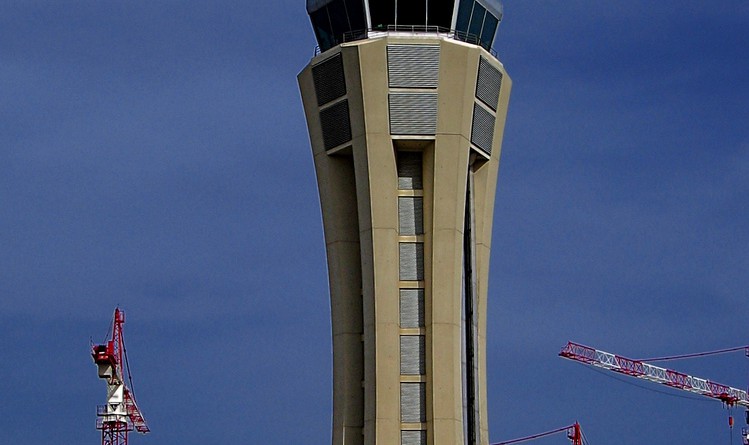
Photo: Málaga ATC tower during the works / Antonio